Toponymy of the Churchill River: a Legacy of the French-speaking Voyageurs
par Léonard, Carol J.
Over 347 kilometres (215 mi) long, the Churchill River is the location of multiple exceptional natural, cultural and historical heritage sites. In fact, there are so many important sites in the Churchill River Basin that it has been proposed as a candidate for the Canadian Heritage Rivers System. Churchill's history has been marked by the forays made by various voyageurs involved in the fur trade. They gave the Churchill waterway and the surrounding region all kinds of French names. These names testify to the veritable golden age of the French language in a region that would later come to be known as Saskatchewan.
Article disponible en français : Toponymie des Voyageurs de la rivière Churchill
Waters that Flow Deep with the Memory of a Unique Heritage
Canada is blessed with an impressive hydrographical system. This natural heritage cuts across the nation in every direction, shaping the country, just as it has shaped its inhabitants. For many centuries, these inhabitants have drawn their food from the various waterways of the system, navigated it and bathed in it. They have also left their mark upon it, for its waterways have been diverted and polluted; rapids have been blocked; and waterfalls harnessed for development purposes. Fortunately, one of the most treasured waterways of this vast system, the matchless, incomparably magnificent Churchill River-otherwise known as the majestic aquatic highway of the voyageurs (NOTE 1) of the fur-trading era-has until now managed to escape man's oft abusive activity. As a result, the Churchill's course through Saskatchewan has remained practically untouched. Isolated and far removed from highly populated regions, the Churchill River has no large urban centres or industrial development along its banks. The contemporary traveller plying its waters will come across only a few northern villages (NOTE 2) where Métis and Amerindians still draw part of their subsistence from the region's rivers, lakes and forests.
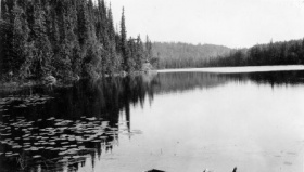
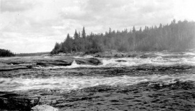
The Churchill River is the crown jewel of the "Alexander Mackenzie Voyageur Route," (NOTE 3) which was declared a national heritage asset in 1995. Today, adventurers and discoverers can navigate its spectacular labyrinth of lakes strung together and studded with islets of granite. The broad waterways occasionally narrow into tight straits where the waters tumble amidst rapids foaming over a multitude of protruding rocks before sinking to the bottom of resounding cataracts. After the waters pour out of Churchill Lake, they travel some 1,609 kilometres (1,000 mi) downstream to Hudson Bay. Its watershed covers 281,300 km2 (108,657 mi2).
When the French Idiom Echoed across the Waters
The Churchill River has been the scene of human activity for nearly 8,000 years. (NOTE 4) The Cree and the Dene people navigated its waters, crisscrossing the region for centuries and their descendants, along with the Métis, still frequently travel the waterways of the region, thereby perpetuating the vibrant traditions of the people. The river's present name comes from the first Duke of Marlborough and governor of the Hudson's Bay Company, John Churchill (1685-91). In fact, this particular designation replaced the native Missi-nipi (Great Waterway), given by the Cree, as well as the Dene names Janes-Deznedhè (Great River) or Yannarè dès nédhè. As for the voyageurs, who ventured by canoe from Montreal and penetrated deep into the interior of the continent to trap and trade furs; they knew the waterway as "English River." This was an anecdotal reference to the Native custom of the Athabascan peoples to take this route to transport their furs to the English trading posts on the shores of Hudson Bay.
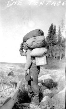
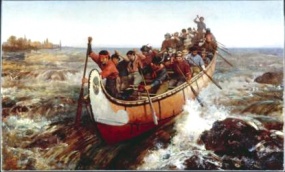
Navigating the waterways of the interior with birch bark canoes invented by Native nomadic hunters and gatherers, the crews of voyagers reached the waters of the majestic Churchill during the 18th century. The section most familiar to them flowed in its entirety within the boundaries of the present-day Province of Saskatchewan. It is a rugged 580-kilometre (360-mile) stretch of water extending from Lac Clair or Lac des Œufs-according to the former French index of names (now Churchill Lake)-to Portage de Traite (today's Frog Portage), a landscape that has remained preserved practically unchanged over the years. The voyageurs reached the Churchill Basin from the Saskatchewan River by the way of two other rivers, the Maligne [the Malicious] and the La Pente [the Slope], whose French names testify to the difficulty of navigating these rivers upstream against the current. Today the two waterways have been united under a single name: the Sturgeon-Weir River. At the western edge of the Churchill River Basin, the voyageur crews went from Churchill Lake to Peter Pond Lake (formerly known in French as Lac des Bœufs [Ox Lake]) by the way of Rivière la Loche [Loach River], then via a lake and portage of the same name. At the end of this up-river journey, they reached the Athabasca Basin, renowned for the rich, luxuriant quality of its furs.
In their commercial logbooks, the traders and their bookkeepers residing at the trading posts recorded their own incessant comings and goings during the fur-trading season when the rivers were navigable. These entries had one noticeable characteristic: they recorded a considerable number of French place names. The logs were almost always written in English. Thus it is obvious that they were not intended for the voyageurs, who were often illiterate and knew no English, and so would not have been able to understand anything that was written therein. As a rule, these documents were intended for the heads of the fur-trading companies, the bourgeois [upper class] as the trappers liked to call them. (NOTE 5) These bourgeois knew the geography of their fur-trading empire very well indeed, having travelled the waterways leading to the "Pays d'en haut" [Upper Country] with their voyageurs. And every time they navigated the waterways of the wilderness, they heard their employees use French names for the lakes, portages and waterfalls that they knew how to cross or avoid better than anyone else on earth. And so, the bourgeois retained a large number of these names, recording them in their account books and on their maps, in accordance with the European cartographical tradition.
According to missionary Émile Petitot, "This [route] is the most scenic, but also the wildest...that we could have chosen in order to penetrate deep into the heart of the North-West." (NOTE 6) The heritage value of this impressive river is based on its physical characteristics: its winding route, its succession of meandering lakes with their labyrinth of archipelagos, the hidden passages and the dangers created by sandbanks, submerged rocks and impassable rapids and falls. Anyone navigating the waterways of the region had to have an excellent knowledge of its watershed-as well as access to an impressive inventory of appropriate [meaningful] place names. Due to their invested interest in safely guiding passengers and transporting merchandise alike, the voyageurs were particularly meticulous in this regard. However, in order to take full advantage of the experience of the Natives who were very familiar with the various safe routes through the region and to avoid cluttering the topographical landscape with a plethora of new place names that could hinder open trade with the Native peoples, they borrowed extensively from the already existing supply of particularly descriptive Native place names. Since they were always travelling by water, the voyageurs had no real opportunity to increase their knowledge of the various languages of the interior, and so, they created their own translated versions of the Native toponymy. In cases where places had not yet been given a Native name, the voyageurs would complete the region's inventory of place names using a nomenclature of their own making. In so doing, their methods often reflected the unique psyche that characterised the trappers and voyageurs of the North who were ever cheerful and made light of the various difficulties and dangers associated with their way of life. (NOTE 7)
The following is a description of what could be called the toponymy of the Churchill voyageurs. It includes the various place names that punctuate the travel logs of illustrious figures such as Alexander Mackenzie, John Franklin and George Simpson, as well as the accounts of lesser-known voyageurs such as Thomas Simpson, Ross Cox and John Richardson.
How the Voyageur Place Names Came into Being
Compared to names in other places, the names given by the Churchill voyageurs are strikingly colourful and prolific. In Saskatchewan, nearly 180 names can be identified whose use dates back to the time of the voyageurs. A hundred or so among them can be found at in the very heart of the Churchill River Basin. The considerable number of place names interspersed throughout the fur-trade agents' notebooks testify to the remarkable degree of activity of the French speakers who trapped and traded along a waterway that crosses a region located more than 3,000 kilometres (1,865 miles) from the St Lawrence Valley.
Aside from its rich variety and colourfulness, the voyageur toponymy has all sorts of other surprises in store. The French-language place names are almost entirely descriptive in nature or, to a lesser extent, anecdotal. Names commemorating individuals are few and far between. On the route from Portage de Traite [today's Frog Portage] to Churchill Lake, there are only two places in the Voyageur inventory that honour specific individuals. The first, Primeau Lake, is named after a certain Louis Primeau, who was a predominant and almost legendary figure from the early days of trading activities on the Churchill. The second, Portage aux Morts [portage of the dead], honours the memory of numerous Native families that disappeared from the region, all victims of the smallpox epidemic that raged between 1780 and 1782.
On the other hand, there is no shortage of descriptive place names. As a matter of fact, such names often describe the most remarkable features of the region. There is Lac de la Montagne [Mountain Lake] and a little farther on is Lac des Côtes [Hillside Lake]. One portage is called De Galets [Pebbles] and there are also Rapides de la Pierre [Stone Rapids] and Portage des Écors [Bark Portage]. Certain qualities and characteristics of the water are alluded to at Lac Vert [Green Lake] and Lac Clair [Clear Lake], as well as at Rivière au Rapide [Rapid River], at Grand Courant [Strong Current] and at Rivière Creuse [Deep River]. There are also names that refer to various features of the region's flora, making it possible to distinguish Portage d'Épinettes [Spruce Portage] from Portage du Bouleau [Birch Portage] and Portage des Halliers [Thicket Portage]. Land and marine wildlife were an even richer source of inspiration. Names evoking furred and feathered game, from the furriest to the completely featherless, succeed one after another. For example, one comes to Lac des Œufs [Egg Lake] and Lac du Bœuf [Ox Lake] after passing through Lac des Souris [Mouse Lake], Lac de la Corneille [Crow Lake], Lac des Serpents [Snake Lake], Lac aux Castors [Beaver Lake], Lac à la Loutre [Otter Lake], Lac à la Biche [Doe Lake], Lac du Cerf [Stag Lake] and even the Rivière aux Caribous [Caribou River]. These bodies of water were named so that the Voyageur would able to identify the various food sources that proliferated in and around them. To the woodsman, a varied diet was important, so he knew that stopping at the foot of Portage la Carpe [Carp Portage] or visiting Rivière la Loche [Loach River] and Rivière aux Brochets [Pike River] or Lac la Truite [Trout Lake] would enable him to vary the menu. It was also well known that one could dip one's net into the generous waters of Lac la Puise [Dipping Lake] to scoop up something to eat for lunch.
The prevalence in the voyageurs' accounts of names that evoke characteristics of the geographical surroundings may be explained by the very nature of the relations that linked fur merchants and inhabitants of the Northwest (NOTE 8). A name referring to an easily recognizable characteristic of the landscape or indigenous wildlife provided a simple, practical way to identify a location in the territory, based on the permanent nature of a particular landmark or point of reference. Both the voyageurs and the bourgeois were first and foremost concerned with making a profit from trapping, trading and selling pelts. Thus, they saw no reason to clutter the landscape with a vast array of new names since this could have created confusion among those with whom they were doing business. It was important to avoid any sort of whimsical methods or practices that might hinder smooth trading operations. The voyageurs therefore made use of many of the already existing Native place names-which they translated into French, so as to accommodate those less familiar with the local Native languages. One must remember that the typical voyageur spent most of his time on the go, ever navigating the waterways of the regions in which he trapped and traded. And so, he did not always have enough time to become familiar with the languages spoken in these far-flung regions.
Nevertheless, the voyageurs did sometimes invent their own names, in a manner that reflected the unique mentality or psyche that characterised the trappers and voyageurs of the North. Therefore, they were very attentive to the swirls and eddies of the Rapide qui Ne Parle Point [Rapids which Do Not Say a Thing], as they were careful of the roaring currents leading to the Portage du Canot [re]Tourné [Tipped Canoe Portage]. The voyageurs loved jokes and jests, and so, they easily remembered place names that alluded to comical anecdotes. Thus, the big lake named Île-à-la-Crosse [Lacrosse Island Lake] is reminiscent of the times when crews played lacrosse on beach of Grosse Île [Big Island]. The voyageurs also shared a special sense of humour with the Natives. Therefore, they often made use of their ever-ready supply of tongue-in-cheek humour to characterize certain specific aspects of the hydrographical landscape. A shallow river would thus be named Creuse [Deep] and a current that was easy to cross would become Grosse Rivière [Broad River]. And so the voyageurs borrowed and created names that were not necessarily strikingly original, but which met the need for reliable points of reference that would enable them to navigate waters that were often demanding and sometimes even treacherous.
The End of an Era
The 1821 merger of the two grand rivals, the North West Company and the Hudson's Bay Company, meant that the voyageurs were gradually put out to pasture. Hudson Bay became the main maritime gateway for the fur trade, and so, the number of trading posts in the interior was cut by more than half. The voyageurs were thus no longer perceived as an indispensable asset. Many of them opted for a settled life on the tracts of land offered them on the Red River. As they were gradually phased out of the fur trade industry, so too was the French language. It gradually resonated less and less among the boulders and rapids and ceased to be heard altogether along the banks of the mighty Churchill River, as it did along the banks of many other a river of the region. Thus, many of the rich and colourful place names were forgotten-names that were an echo of those used by the Native peoples who had wandered the region's forests for ages or names that were the result of spontaneous inspiration due to the voyageurs constant intimate contact with the serendipitously calm and sometimes raging waters of this powerful river.
And so a new set of place names would come to dominate the vast reaches of the Northwest's landscape; names in English that the Hudson's Bay Company had acquired from the "discoveries" of company geographical and cartographical explorers such as Samuel Hearne, Peter Fidler, Philip Turnor and David Thompson. The French place names disappeared little by little from both the new maps and from people's memories. Names such as Lac de la Queue Dépouillée [Bare-Tail Lake], Portage du Canot Tourné [Overturned Canoe Portage], Rapide du Genou [Knee-high Rapids], Portage du Hallier [Thicket Portage], Lac des Bœufs [Ox Lake], Portage de Aurice [Aurice Portage], [Lac du Diable] [Devil's Lake], Portage des Épingles [Pin Portage], [Rapide de l'Équerre [Right-Angle Rapids] and Fontaine de Roche [Rock Waterspout] were kept buried for years in the archives, just waiting to be rediscovered and used once again.
In spite of everything, a few place names dear to the voyageurs resisted disappearing into history because of their frequent use. They have been passed on from generation to generation, their use continuing to the very present. Although few in number, these place names stand out due to size of the entities to which they so masterfully refer. Thus, Lac la Ronge, Lac Île-à-la-Crosse, Lac la Loche and Primeau Lake still designate vast bodies of water that are among some of the most substantial, if not the most impressive the modern-day voyageurs of the region may ever contemplate.
Honouring the Memory of the Voyageurs in Name and in Deed
No doubt judging that insufficient tribute had been paid to the important figures of the pioneer era, during the 1960s, Saskatchewan's provincial authorities decided to enrich the boreal toponymy in the heart of the Churchill River Basin, as well as outlying areas. They did so by naming various location after some of the best-known French-speaking voyageurs and fur traders. Among the most noteworthy, commemorative place names are those of Lac Blondeau (Bartélémi Blondeau), Lac Cardinal (Joseph Cardinal), Lac Charbonneau (Jean-Baptiste Charbonneau), Lac Deschambault (Pierre Fleury Deschambault), and Lac Versailles (Louis Bourquin, alias Versailles). The list also includes the small northern community of Bélanger named in honour of the head trader Horace Bélanger.
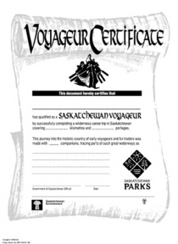
Today, during the warmer months of summer, the Churchill River Basin welcomes a large number of vacationers who have expressly come to enjoy a region known as one of Saskatchewan's most beautiful. Desiring to assist the greatest number of vacationers possible-so as to enable them to fully enjoy the pleasure of visiting this magnificent river and its tributaries-Saskatchewan Environment offers outdoor enthusiasts (whether canoeist or kayaker) detailed information on the more than 50 routes that can be navigated during the summer months. Rookie boaters, as well as experienced canoeists, can choose from among a variety of documented, well-marked itineraries. The shortest is about 20 kilometres (12.5 miles) long and the longest stretches out for more than 350 kilometres (220 miles). This wide variety of canoe routes and circuits makes it possible to explore the complex labyrinth of the Churchill River Basin all directions. In the midst of the region's vast, beautiful and wild natural setting, canoeists can discover an extraordinary variety of landscapes that resemble, in every way, the wilderness upon which the voyageurs first set their eyes two centuries before. Once having finished any one of the numerous circuits, the vacationing ‘explorers' can receive a certificate making them modern-day Saskatchewan voyageurs. The provincial authorities not only use the certificate as a means of officially approving only those who make their forays into the wilderness using the methods of bygone days, but they also pay solemn homage to those who navigated the region's waterways long before the Province of Saskatchewan even existed. It is a way of honouring those proud trappers and voyageurs of the North who once enjoyed the best and faced the worst that fickle, generous yet ruthless Dame Nature could throw their way.
Carol J. Léonard
Campus
Saint-Jean
University of Alberta
NOTES
Note 1: The term "voyageur" is italicized and left in French in order to distinguish those hired by fur-trading companies from the explorers intent on discovering new lands.
Note 2: The population of each of the main centres (Stanley Mission, Pinehouse Lake, Île-à-la-Crosse and La Loche), barely exceeds 1,000 inhabitants.
Note 3: Covering 8,600 kilometres (4,970 mi), the "Alexander Mackenzie Voyageur Route" stretches from Quebec City to Bella Coola, British Columbia. Numerous national historic sites and many commemorative plaques are scattered along the route, which crosses two national parks (Pukaskwa and Wood Buffalo) and follows five heritage rivers (the French, Mattawa, Boundary Waters, Churchill and Clearwater rivers). These waterways cover roughly 900 km (560 mi) and offer adventurous Canadians of today the possibility of travelling by canoe through this national heritage asset.
Note 4: Certain vestiges discovered in the Buffalo Narrows region belong to the so-called Angostura period, and apparently date back 7,500 to 8,400 years.
Note 5: This is what the voyageurs called both the shareholders of fur-trading companies and the independent merchants who hired workers on their behalf.
Note 6: Émile Petitot, En route pour la mer Glaciale (Paris: Letouzey, 1887), p. 260. [Original citation translated into English]
Note 7: Ibid., p. 249.
Note 8 The term Northwest is a translation of the French term "Nord-Ouest", which was used by the voyageurs to refer to what is today known as Saskatchewan (mostly Northern and Central Saskatchewan).
BIBLIOGRAPHY
Cox, Ross, Adventures on the Columbia River, including the narrative of a residence of six years on the Western side of the Rocky Mountains, among various tribes of Indians Hitherto unknown: together with "a journey across the American continent", New York, J. & J. Harper, 2003, 398 p.
Franklin, John, et Richard C. Davis, Sir John Franklin's journals and correspondence : the first Arctic land expedition, 1819-1822, Toronto, Champlain Society, 1995, 2 volumes.
Gates, Charles, Five fur traders of the Northwest : being the narrative of Peter Pond and the diaries of John Macdonell, Archibald N. McLeod, Hugh Faries, and Thomas Connor, St. Paul, Minnesota Historical Society, 1965, 296 p.
Léonard, Carol Jean, Une toponymie voilée : Problématique des noms de lieux particulière à une minorité linguistique, la Fransaskoisie, Thèse de doctorat, Université Laval, Québec, 2006, 1 333 p.
Mackenzie, Alexander, Voyages from Montreal on the river St. Laurence, through the continent of North America to the Frozen and Pacific Oceans in the years 1789 and 1793, With a Preliminary Account of the Rise, Progress and Present State of the Fur trade of that Country, Edmonton: Hurtig, 1971, 412 p.
Marchildon, G. P., et S. Robinson. Canoeing the Churchill : a practical guide to the historic voyageur highway, Regina, Sask., Canadian Plains Research Center, 2002, 477 p.
Petitot, Émile, En route pour la mer Glaciale, Paris, Letouzey, 1887, 394 p.
Simpson, Thomas, Narrative of the discoveries on the north coast of America, effected by the officers of the Hudson's Bay Company during the years 1836-39, Toronto: Canadiana House, (1970), 2 volumes.
Taché, Alexandre, Esquisse sur le Nord-Ouest de l'Amérique, Montréal, Beauchemin, 1901, 184 p.

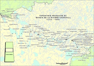
![The sinuous aquatic highway of the voyageurs, stretching from Rivière La Pente [today's Sturgeon-Weir River] at the bottom right-hand corner of the map to Lake La Loche at the top left-hand corner, C. J. Léonard, 2007](/media/thumbs/534/285x0-ILLUSTRATION_2__La_sinueuse_avenue_d_eau_des_Voyageurs__C_.jpg)
